
Interactive Geologic Maps and Educational Content
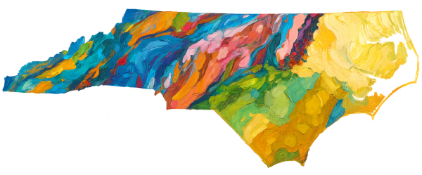
Explore our interactive content webpage that includes the 1985 Geologic Map of North Carolina. Interactive content includes educational ESRI Storymaps and ArcGIS maps. You do not need an ArcGIS license, or be an ArcGIS user, to view and interact with this content.
NCGS Interactive Maps and Content
NCGS Publications, Geologic Maps, and Miscellaneous Publications
You can view, download, and purchase Statewide Geologic Maps, including the 1985 Geologic Map of North Carolina on the Statewide Geologic Maps of North Carolina webpage.
You can also use the interactive version of the 1985 Geologic Map of North Carolina on our Interactive Content webpage.
Bulletins are detailed scientific studies that include comprehensive and interpretive reports of significant interest and importance. Bulletins feature in-depth analysis of new data and have undergone internal and external peer review.
Bulletins, with links to digital downloads, can be found on our Bulletins page.
Information Circulars fall into one of two categories:
- Presentation of scientific data on a variety of topics that are not as in-depth as Bulletins, or
- Publications intended for the general public, written in plain language on geologic topics related to North Carolina.
Information Circulars undergo internal NCGS review and often demonstrate how geology addresses public interest issues and can inform public policy and management decisions.
Information Circulars, including links to digital downloads, can be found on our Information Circulars webpage.
Open-file Reports are a collection of reports and/or maps representing preliminary research findings. They are not considered to be formal literature and may be superseded by updates or final products. Open-file reports are of the best available information for geological mapping in some areas and are internally reviewed for completeness and conformity to NCGS mapping standards.
You can browse these reports and maps, with links to digital downloads, on our Open-file Reports webpage.
You can view these historical reports and maps, including links to digital downloads, on the Open-file Reports and Maps page.
Special publications are a diverse series covering topics like structural geology, energy and minerals, and paleontology. These publications may be in cooperation with other agencies and often report findings from research conducted by non-survey scientists. These publications are subject to internal and external review.
You can browse the Special Publications, including some links to digital downloads, on our Special Publications webpage.
In comparison to Open-file Report maps, these maps have undergone additional internal and external review and refinement. They typically include detailed information relevant to the mapped area such as minerals resource summaries, locations of mines, quarries, and geochemical and age date sample locations. These maps are considered part of the formal geological literature and are usually published as final products.
Browse the maps on our Geologic Map Series webpage.
Last published in 1982, this map series presented the results of regional mapping across the state and was later compiled into the 1985 Geologic Map of North Carolina.
You can view the list of maps on our Regional Geologic Map Series webpage.
NCGS Volumes are a discontinued publication series last published in 1923. The Volumes publication was a limited series consisting of five volumes. Three of these Volumes are comprehensive reports on geologic topics.
You can view the Volumes on the Volumes webpage. If you have questions about the NCGS Volumes series, please contact Michael Medina at michael.medina@deq.nc.gov.
Publications on the Field Trips Guidebook webpage were prepared for professional meetings regarding the geology of North Carolina.
You can browse the Guidebooks with digital downloads on the Field Trip Guidebooks webpage.
Ordering Maps and Publications
NCGS Sales Office
Phone: 919-707-9203
Email: Michael Medina
Sales Office orders are accepted by telephone, facsimile, e-mail or in person. Payment may be made by credit card (Mastercard, Visa or American Express), personal check or cash. Walk-in visitors can find parking in a public parking deck located about 1 block south of the Archdale Building on Salisbury Street. There is also metered parking on Salisbury Street, and unmetered parking north of Peace Street. Our map and publication sales facility is located on the 5th floor of the Archdale Building, Suite 527.
NCGS Online Store
Out-of-Print Publications
Out-of-Print publications may be examined in the NCGS Archdale Building office in Raleigh. Most publications can also be obtained by interlibrary loan from the State Library. Some out-of-print publications have been scanned and are available as Adobe PDF files.
The NCGS will photocopy out-of-print publications (or portions of the publications) as a convenience to clients, for a modest charge. Please make arrangements with our publication sales staff Michael Medina if you are interested in obtaining an out-of-print publication. Sales tax is applicable to orders destined for North Carolina.
U.S. Geological Survey
Search the National Geologic Map Database for most recent USGS publications
Theses and Dissertations
Theses and dissertations are held in the NCGS office which most closely matches the area of responsibility (Coastal Plain, Piedmont, or Mountains) of the thesis or dissertation. The North Carolina Geological Survey maintains lists of theses and dissertations in its holdings (see Open-file report 90-2). Also available are theses and dissertations by county, currently held in the NCGS main office. For a list of holdings for the Coastal Plain (984.389.4100) or Asheville (828.296.4500) offices.
- Theses and dissertations sorted by last name;
- Theses and dissertations sorted by county; and
- Theses and dissertations sorted by topic.