Riparian Buffer Rules Education and Outreach
What is a Riparian Buffer?
What are the NC Riparian Buffer Rules?
- North Carolina Riparian Buffer Rules Brochure
- General Buffer Rules Information
- Riparian Buffer Protection Program website
- 401 & Buffer Permitting Statutes & Rules website
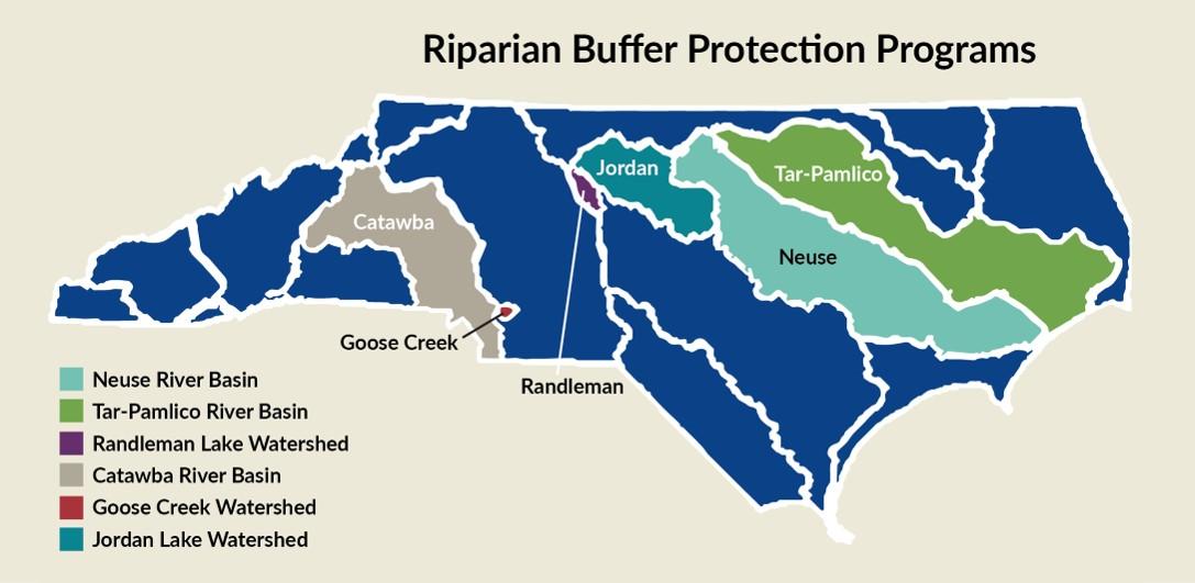
Where are the buffer rules applied?
Below is an infographic showing the areas where riparian buffer buffer rules are applied in North Carolina.

Educational Resources:
| Infographics and Images for Download and Use | Click the following links to below images: |
|---|---|

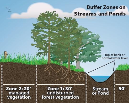
| Buffer Zones |

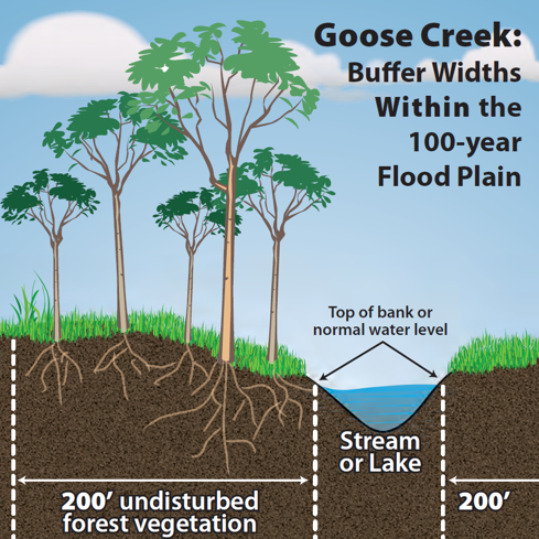
| Goose Creek- Within 100-yr Floodplain |

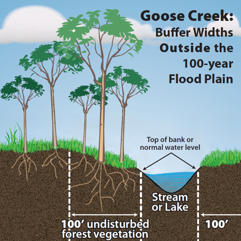
| Goose Creek- Outside 100-yr Floodplain |
Questions?
In April 2021 NCDWR and Water Resources Research Institute (WRRI) hosted a training on the NC Riparian Buffer Rules. The training was created for locally delegated governments. Please find the recordings of that training here. These recordings are a great way to train new staff and to act as a refresher course. You can watch the entire full training, or watch the individual videos that cover one topic. As always, if questions arise, please contact DWR staff or your local government for more information.
*Fact sheets coming soon!*
| Brochures and Fact Sheets for Printing or Posting | |
|---|---|
| General | Catawba River |
| Neuse/Tar-Pam | Jordan Lake |
| Goose Creek | Randleman Lake |
These presentations were created for and presented at the 2021 Buffer Rules Training.
| PowerPoint Presentations (PDF) | |
|---|---|
| The Science of Buffers | Ordinance Compliance and Enforcement Overview |
| What are the NC Riparian Buffer Rules (General Overview) | Riparian Buffer Education Outreach Strategies |
| Buffer Authorizations | Nutrient Management Strategies |
| Forestry Practices | |
-
Train new staff using the recorded training
-
Print and distribute fact sheets and brochures to developers, realtors, new homeowners, engineers, architects, etc.
-
Post the video on your social media channels
-
Share these links/materials on your social media channels
-
Host a Riparian Buffer Awareness week or month as a social media campaign. Ask your staff and partners, and followers to post buffer selfies near waterways
- Riparian Buffer Protection Programs Map (PDF)
- NC Riparian Buffer Area Map (Online interactive map)
- Randleman Lake Watershed Map (PTWRA.org)
- Most Recent published NRCS Soil Survey - *you may need to try different browsers to view the maps*
- NRCS Soil Surveys for North Carolina (by county) – web soil survey is not acceptable/allowed, need to use the printed NRCS soil survey
- USGS topographic maps (USGS Store Map Locator & Downloader)
- USGS Topo/ NRCS Published Soil Survey Mapping Tool
